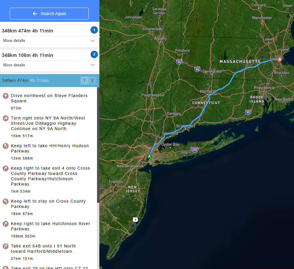
SatelliteViewMaps: Feature
KEEPING IT SIMPLE
Whether traveling by car, bicycle, or walking - find directions in a snap! All you have to do is enter your current location, where you’d like to go and select your mode of transportation. Once directions appear, click ‘Print Directions’ - that’s it!
WALKING
Getting Walking Directions
To select ‘Walking’ as your mode of transportation, click on the pedestrian icon. SatelliteViewMaps will present a route that includes walking-friendly routes.
CYCLING
Getting Cycling Directions
To select ‘Cycling’ as your mode of transportation, click the bicycle icon. SatelliteViewMaps will adjust the directions to a bike-friendly route.
DRIVING
Getting Driving Directions
Traveling by car is the default mode of transportation. But if you’ve previously selected ‘Walking’ or ‘Cycling,’ all you have to do is click the car icon to find the fastest route to your destination.
ACCESSING THE WIDGET
You can start using SatelliteViewMaps in just one click! Here’s all you need to know.
1
Opening the Widget
Access SatelliteViewMaps at any time by clicking on the icon. You can also move the widget or icon wherever you’d like within your browser.
2
Reactivating the Widget
If disabled, you can easily reactive the widget by clicking the SatelliteViewMaps icon at the top right of your browser, then select ‘Enable Everywhere’.
3
Closing the Widget
Once done using SatelliteViewMaps, you can close the widget by clicking the 'X' icon to close.
4
Disable the Widget
To snooze or disable the SatelliteViewMaps widget, click the Settings icon to view a menu with these options.
DIRECTIONS & PRINTING
SatelliteViewMaps: Steps
Click "Add to Chrome"
Driving Directions
Kick off installation by clicking the"Add to Chrome" button.
Add to Chrome
Fastest Route
Once in the Chrome Web Store, click"Add to" in the upper right corner.
Print Share
Confirm Installation
Click "Add to Chrome" to confirm installing the extension.
Arrow
1. Click 'Continue to installation'
2. Click 'Add'